
|
Let's look at Tectonic Processes. These are the forces that are trying to build the earth. Physical evidence of this happening includes volcanoes, earthquakes, folds, and faults. |
Contents |
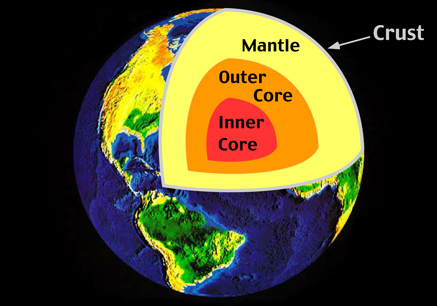
| Internal Structure of the Earth Knowledge has come from studying seismic waves which are generated by earthquakes and are registered on seismographs. Types of Seismic Waves1) Body Waves: travel through the interior of the earth a) primary (P) or compression waves: travel fastest through any material b) secondary (S) or shearing-deformation waves: travel only through solid materials 2) Surface Waves: travel only through the crust (i.e. L or long waves) Layers of the Earth
|
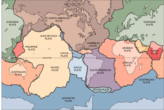
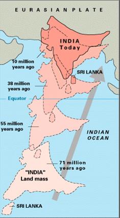
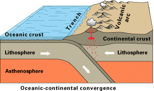
Plate Tectonics"The earth's surface is broken into seven large and many small moving plates. These plates, each about 80 km thick, move relative to one another an average of a few centimetres a year. Three types of movement are recognized at the boundaries between plates: convergent, divergent and transform-fault [i.e. slip and slide]. At convergent boundaries, plates move toward each other and collide. Where an oceanic plate collides with a continental plate, the oceanic plate tips down and slides beneath the continental plate forming a deep ocean trench (long, narrow, deep basin.) An example of this type of movement, called subduction, occurs at the boundary between the oceanic Nazca Plate and the continental South American Plate. Where continental plates collide, they form major mountain systems such as the Himalayas. At divergent boundaries, plates move away from each other such as at the Mid-Atlantic Ridge. Where plates diverge, hot, molten rock rises and cools adding new material to the edges of the oceanic plates. This process is known as sea-floor spreading. At transform-fault boundaries, plates move horizontally past each other. The San Andreas Fault zone is an example of this type of boundary where the Pacific Plate on which Los Angeles sits is moving slowly northwestward relative to the North American Plate on which San Francisco sits. Plate tectonics, the branch of science that deals with the process by which rigid plates are moved across hot molten material, has helped to explain much in global-scale geology including the formation of mountains, and the distribution of earthquakes and volcanoes" (http://geology.er.usgs.gov/eastern/plates.html).
|
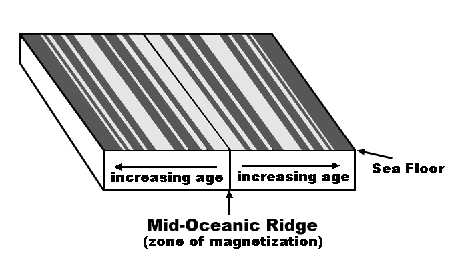
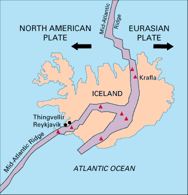
Summary of the Three Kinds of Plate Divisionsa) Diverging Plates eg Mid-atlantic ridge
b) Converging Plates
i.e.
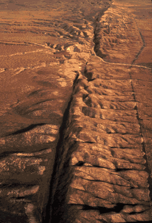
c) Slipping and Sliding Motion eg San Andreas Fault The Pacific plate is moving northwest at approximately 5 cm per year past the North American plate Note: The San Andreas fault is also known as a transform fault, slip fault, or tear fault.
|
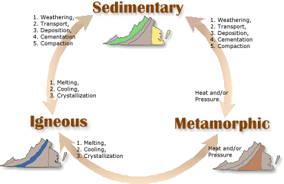
Rock Types A rock is a collection of one or more minerals.
Rocks are divided into three major groups.
Note: deposits from shallow and deep marine areas (i.e. organic
deposits) eventually form coal, oil, and natural gas (i.e.
fossil fuels)
The Rock Cycle
|
| Folds and Faults: https://openpress.usask.ca/geolmanual/chapter/overview-of-folds-faults-and-unconformities/ |
EarthquakesWithin the earth, about a million tremors are produced each year.
Of these, about 1000 are major earthquakes. Most of these do not
make headlines because they occur in unpopulated areas or under oceans.
- Near coastlines, harbors and rivers, they can make the wet, sandy
soil jiggle, turning it temporarily from a solid to a liquid state.
Heavy sand and rock sinks, while water and lighter sand bubble to
the surface. The slurry spreads, often toward the water, and the
surface shifts. This is known as liquefaction. Causes of Earthquakes Magnitude Magnitude is the total amount of energy released by an earthquake, and consequently, the amount of ground motion it causes. Magnitude is measured using the Richter Scale. The scale grows by a power of 10 for each 1.0 increase in magnitude. Hence, a 5.0 earthquake is 1000 times (10 x 10 x 10) greater than a 2.0 earthquake. Intensity The intensity of an earthquake is a value that reflects the effect produced. Intensity is measured using the Modified Mercalli scale. |
Earthquakes: Further InformationWhy is the west coast of British Columbia vulnerable to earthquakes? |
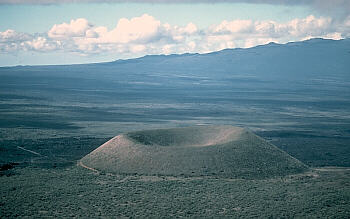
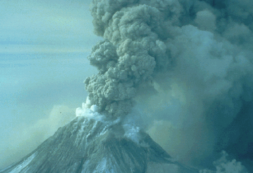
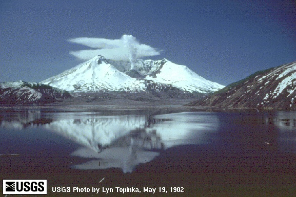
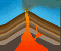
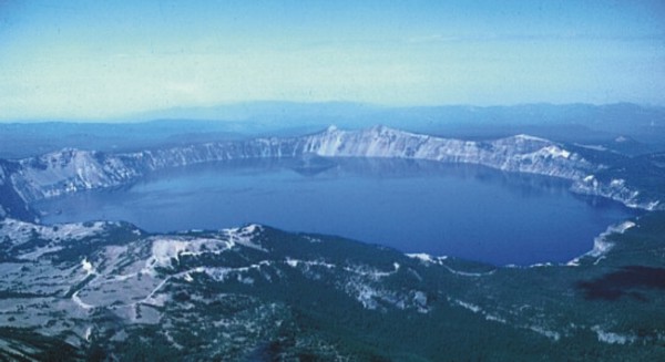
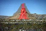
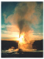
VolcanoesCauses Types of Lava / Magma Andesite: high viscosity, thick and slow moving, silica rich, greater risk of a violent eruption as gases are trapped by its thickness so pressure builds. Basalt: low viscosity, more fluid and fast flowing, maganesium-rich,
less risk of a violent eruption as gases can more easily escape.
3)
Composite
Cone (or sometimes called Stratovolcanoes)
VOLCANIC EXPLOSIVITY INDEX
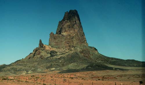
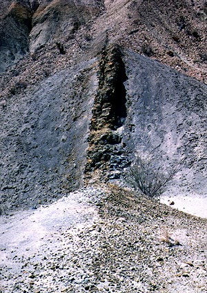
volcanic neck or plug: volcanoes, of course, are extrusive igneous features -- but part of a volcano cools underground and is considered an intrusive igneous feature. This feature is known as the volcanic neck or plug. eg old volcanic neck
eg a dike uncovered
|
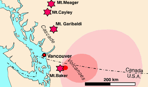
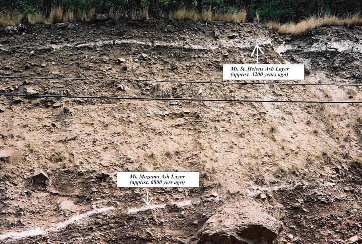
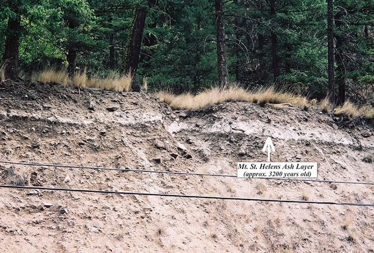
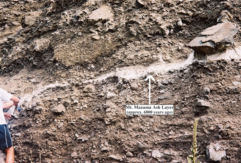
| Canadian Volcanoes |


 Courtesy:
USGS
Courtesy:
USGS


|
Assignment Work
|
|
1) Download, print out, and
complete the Tectonic Processes Exercise utilizing the
information above as well as the links. Put this work in the "Systems
of the Earth" section of your notebook. This will be the
case for all assignments for Units 3 through 10. |
| ©www.coolschool.ca | Press
the |