
|
It is time to review your Tectonic Processes Knowledge in preparation for the Unit Test. |
|
Tectonic Processes Review
Click on a selection to see if you are correct. 1. The most common type of volcano associated with the process illustrated in the diagram below is A. shield. B. caldera. C. basaltic. D. composite. Explanation
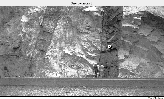
2. The greatest threat to people living in the region of Mt. St. Helens in 1980 was a(n) 3. Feature X in the photograph below is a 4. The type of rock associated with feature X in the photograph is
5. The diagram that best illustrates the type of movement found along the San Andreas fault is
6. The process illustrated in the diagram below is A. reverse faulting. B. plate divergence. C. isostatic adjustment. D. crustal convergence. Explanation
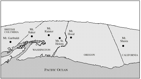
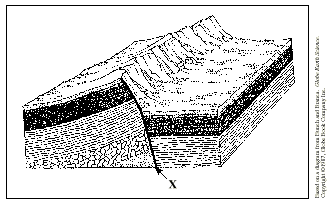
7. Volcanoes such as Mt. St. Helens and Mt. Baker are a result of the A. subduction of an oceanic plate. B. divergence of two continental plates. C. convergence of two continental plates. D. movement of an oceanic plate over a hot spot. Explanation 8. Feature X in the diagram below is a A. sill B. dike C. laccolith D. batholith Explanation
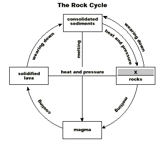
9. The process responsible for the feature X in the diagram above is A. sedimentation B. igneous intrusion C. chemical solution D. hydrothermal activity Explanation 10. The type of rock associated with the strata at X below is A. igneous B. magmatic C. sedimentary D. metamorphic
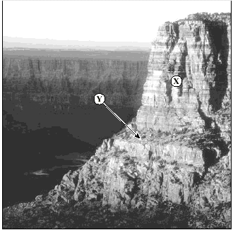
11. In the photograph below, the feature identified at Y is a(n) A. rift. B. sill. C. dike. D. esker. Explanation 12. In the photograph, features X and Y were formed as a result of A. glaciation. B. vulcanism. C. folding and faulting. D. river and wind deposition. Explanation
13. Ocean plates are primarily composed of A. basalt. B. gneiss. C. granite. D. andesite. Explanation 14. The mountains labelled on the map below resulted from A. rifting. B. isostasy. C. subduction. D. tear faulting. Explanation
15. The mountains labelled on the map above are A. shield cones. B. fold mountains. C. block mountains. D. composite cones. Explanation 16. The process illustrated in the diagram below is A. rifting. B. folding. C. subduction. D. translocation. Explanation
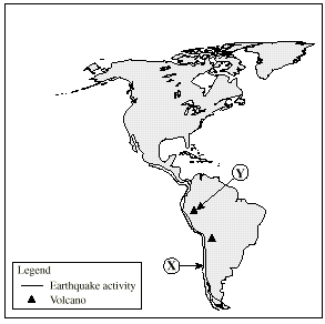
17. The earthquake activity at X, indicated on the map below, is the result of A. tear faulting. B. diverging plates. C. a transform fault. D. a subducting plate. Explanation 18. Volcanic rocks at Y are composed of A. basalt. B. granite. C. andesite. D. sandstone. Explanation
19. If during a violent eruption a volcano collapses, the resulting feature will be a A. sill. B. dike. C. geyser. D. caldera. Explanation 20. Where are both volcanism and earthquake activity currently taking place? A. Grand Canyon B. Canadian Shield C. Mid-Atlantic Ridge D. Himalayan Mountains Explanation 21. If the process illustrated in the diagram below continues, the resulting feature will be a(n) A. island arc. B. rift valley. C. fold mountain. D. shield volcano. Explanation
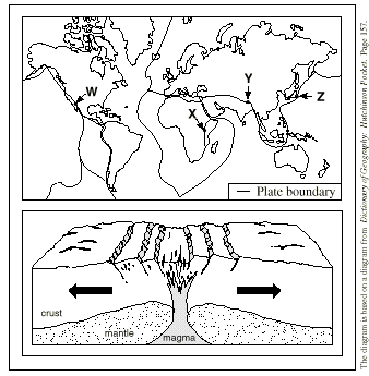
22. An example of a sedimentary rock is A. basalt. B. granite. C. marble. D. sandstone. Explanation 23. Batholiths and sills are evidence that an area has experienced A. carbonation. B. river deposition. C. igneous activity. D. extensive wind erosion. 24. Which process creates synclines? A. tension B. weathering C. compression D. river erosion Explanation 25. Earthquakes may cause a A. tsunami. B. tidal bore. C. storm surge. D. spilling wave. Explanation 26. The process illustrated in the diagram below occurs at map location A. W. B. X. C. Y. D. Z. Explanation 27. The plates in the diagram below are moved by A. isostasy. B. subduction. C. mass movement. D. convection currents. Explanation
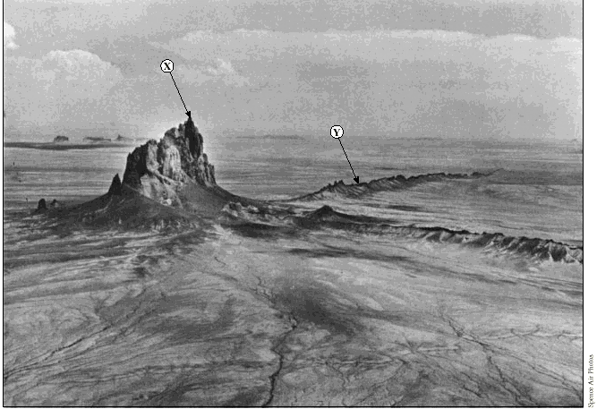
28. The islands located at X below formed as a result of a A. transform fault. B. subducting plate. C. converging plate. D. rising magma plume. Explanation 29. The feature associated with location Y on the map below is a(n) A. tear fault. B. rift valley. C. ocean trench. D. divergent plate. Explanation
30. Rock type X in the diagram below is A. igneous. B. precipitate. C. sedimentary. D. metamorphic. Explanation
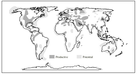
31. Data on the map below suggests that in the future, the largest supply of fossil fuel energy will likely come from A. inland basins. B. ocean trenches. C. continental shelves. D. recent alluvial deposits. Explanation
32. Magmatic intrusion along the fault marked X would result in a A. sill. B. dike. C. laccolith. D. batholith. Explanation
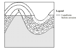
33. Before erosion altered the landform in the diagram below, feature X was a(n) A. graben. B. volcano. C. syncline. D. anticline. Explanation
|


|
Assignment Work
|
|
1) Begin studying for the Unit Test and do the review questions above.
|
| ©www.coolschool.ca | Press
the |